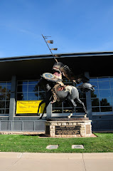
We were surprised at how much of the Mother Road is still drivable. Of the eight states we visited along the way, Illinois does BY FAR the best job of preserving what is left of the old road, the old gas stations, the cafes and motels that once saw so many travelers with so many dreams of what lay ahead, down the road.
California does the WORST job of preserving and promoting the Mother Road. The explosive growth of the L.A. basin has demolished almost all traces of the old road.
Oklahoma and New Mexico are right behind Illinois in pampering the memory of Route 66. Missouri and Texas are next. Eastern Arizona is almost devoid of evidence that the Mother Road passed through. Western Arizona is much better, especially from Seligman to Needles.
It is still possible to make the journey and experience some of the essence of what it was like “back then” to get your kicks on Route 66. Get out there and DO it!
Monday, November 3, 2008
October 18--Santa Monica


We take the Arroyo Seco Parkway (one of several former alignments of Route 66 in L.A.) from Pasadena to Santa Monica. We find the historical terminus of Route 66 at the intersection of Lincoln Dr. and Olympic Blvd. We find NO signs or markers to note the significance of this site. It is simply lost in the din of the big city. At least Chicago has the class to maintain the legend of Route 66 by signs and markers. We drive six blocks to the Santa Monica Pier, the “unofficial” terminus of Route 66. We take each other’s photo standing at the pier entrance and enjoy the magnificent southern California morning. Restless to be home, we head straight for I-405 and, eight hours later, we roll into our driveway. We have traveled 6100 miles since we left on September 22.
October 17--Pasadena


Not far out of Needles on I-40, we exit back onto old Route 66 and head for Goffs, Fenner and Chambless. All of these towns are defunct and boarded-up. Even Amboy, the town that sold for $350,000 a few years ago, is limited to one live business: Roy’s Café.
Moving on toward Ludlow and Newberry Springs, we pass the site where the original Bagdad Café stood. A solitary palo verde tree marks the spot. Slowing for Ludlow, we see a few more cars than in Amboy. At Newberry Springs, we see the “new” Bagdad Café, where the film Bagdad Café was shot. The café has truck-stop “cuisine”, a token gift shop and looks very tired and unhappy. We decide to move on to Barstow for lunch.
Barstow, also a railroad town, is somehow nicer and newer and cleaner than Needles. We find the Canton Restaurant (recommended) and have a nice Chinese lunch plate. Yummy. Down the road, we find the exquisite Route 66 Motel, a classic Mother Road establishment, complete with rusty old cars and other vintage props.
We arrived so early in Barstow that we decide to press on toward Glendora. We bypass the 36-mile stretch of the Mother Road from Barstow to Victorville and decide to save Victorville for another visit. Beyond Victorville, the Road joins I-15 for most of the way to San Bernardino.
By this time, the Friday-afternoon traffic is thick, so we elect not to cruise the 30+ miles along Foothill Blvd. (old Route 66) through San Bernardino, Rialto, Monrovia, et. al. We arrive at our hotel in Pasadena at 4:30 pm.
Tomorrow, the finish at Santa Monica pier.
Saturday, October 18, 2008
October 16, Thursday--to Needles


Today’s destination: Needles, CA
After breakfast at the Holiday Inn, we take another tour of downtown Williams for some photos. Soon, we discover The Quilter’s Mercantile Store, which immediately swallows Ann whole. While she is attempting to escape its clutches, I walk the main street looking for photo-ops.
Leaving town, we are forced to join the interstate for about 8 miles until we escape onto the Mother Road for a 159-mile stretch of uninterrupted, 1930’s pavement. We arrive in Seligman, home of the “Father of the Mother Road”: Angel Delgadillo. Angel’s old barbershop has morphed into the best Route 66 souvenir shop we have seen. Angel is taking the day off, but his wife and daughter are on duty to deal with two busloads of tourists who arrive about 5 minutes after we do. One of the buses is loaded with Japanese tourists and they swarm the shop like army ants. We escape to the street to see the Snow Cap Drive-In, also founded by the Delgadillos It is clear that Seligman has become a Route 66 museum and curio-shop town. All along the main street, we see tourist shops full of the same-old, same-old. Only The Delgadillos seem to have chosen the “right stuff” to sell. We do get some good photos of the Roadkill Café and its clientele.
Leaving Seligman, the road arches northward toward Peach Springs. Along the way, we see a succession of Burma-Shave signs. If you remember these from the old days, they have a message spread across four signs placed about a tenth of a mile apart and a final sign saying just Burma Shave. Here are some of the gems we encountered:
It would be more fun
To go by air
If we could put these signs
Up there
Burma-Shave
The one who drives
When he’s been drinking
Depends on you
To do his thinking
Burma-Shave
If daisies are
Your favorite flower
Keep pushing up
Those miles per hour
Burma-Shave
Big mistake
Many make
Rely on horn
Instead of Brake
Burma-Shave
On past Peach Springs, Truxton, Crozier and Valentine, we find the road in good condition and the vistas magnificent. At Hackberry, we stop at the general store, another Route 66 museum and gift shop. But there are tons of splendid artifacts, old vehicles, service station tools and Burma-Shave signs to see. A 1956 Corvette sits in front of the store.
In Kingman, we have lunch at Mr. D’z, an authentic Route 66 café with authentic décor, food and patrons. We take a miss on the Arizona Route 66 Museum across the street from Mr. D’z and press on toward Oatman.
The legendary Oatman highway is a twisting, narrow road up and over Sitgreaves Pass (el. 3550). The road is in good condition but the precipices are steep and Ann spots a burned-out hulk of a car at the bottom of one of the cliffs. They didn’t read the Burma-Shave signs. The road down into Oatman is equally tortuous and delightful.
Oatman is a tourist trap of gigantic proportion. We arrive in the middle of a (scheduled) mock gunfight in the middle of the only street through town. The semi-authentic, old-west, outlaw, gunslinger theme has overpowered the Route 66 Grapes-of-Wrath theme here in Oatman. We both agreed that Oatman is way over the top in kitsch and cheesy commercialism. The resident committee of free-ranging street-burros wanders aimlessly among the crowd of camera-toting tourists, begging for a handout of snacks. Too cute for words.
Escaping Oatman without ever leaving the car, we motor serenely down into Topock and approach the Colorado River and California. At the border, we are forced to join I-40 briefly as we sail into Needles. We have been through Needles many times during the past 30 years and have always tried to avoid stopping or staying there. It was built to serve the railroad and is now one big truck stop. After having read the dismal reviews of places to stay in Needles, we decide to try a suggestion from the Route 66 Dining and Lodging Guide. We find Fender’s River Road Resort in west Needles, right on the Colorado River. It is vintage Route 66: clean, funky and nostalgic. No internet connection, but a full DirecTV menu. The air conditioner is noisy and the bathroom hardly has water pressure, but it is only for one night.
Thursday, October 16, 2008
October 15-Wednesday, to Williams, AZ


We spent Tuesday in Payson for an off-day with friends.
We arrive back in Winslow at about 11:00 am from Payson. We troll slowly through “downtown” on Old Route 66 and find the splendid 1930 La Posada Hotel. It is gorgeous and we have lunch in the Turquoise Room. Delicious! We wander the hotel for a while, taking photos and enjoying the distinct atmosphere of an opulent, bygone era. The hallway containing the restrooms is lined with framed photos of notable guests of La Posada, including Albert Einstein. Winslow is and always was a railroad town and La Posada was constructed as a place for well-heeled travelers to pause on their rail journey through Arizona.
Next stop is Meteor Crater. It is NOT on Route 66, but is irresistible. This impact crater is 50,000 years old and is well worth the visit. See photo.
Back on I-40, we head for Winona (“…don’t forget Winona”) and Flagstaff. The Mother Road along this path is dirt or gravel, so we stick to the pavement of the interstate. Winona is just a few buildings and some nice trees. We see no gas stations, motels or curio shops.
Flagstaff is a classic Route 66 town: 10 miles long and 10 blocks wide. The old downtown section has several nice, old hotels and the narrow streets have been made one-way to accommodate modern traffic.
Pressing on into Williams, again mostly on I-40, we arrive at about 3:00 p.m. to see a giant pall of smoke wafting over the town from the south. It turns out to be a “controlled burn” by the Forest Service. Fortunately, the burn has been extinguished and the 10 mph wind drives the smoke away from town. After check-in at our hotel, we walk the main street of Williams and find several well-preserved and active hotels from the 1950s. Especially nice is the Route 66 Lodge. We hit a couple of nice souvenir shops and then have dinner at Pancho McGillicuddy’s (Mexican food). We get back to the hotel just in time to watch the third and final Presidential debate.
Ann's Bit:
Natalie left a good alien joke a few days ago. Thanks, Natalie!
I complained to one of my CA friends about the lack of (fabric) shopping. Ok, folks, really really rural America is what we are in. Small towns cannot support fabric shops. And so many quilt stores are closing, fully half of the ones I call are gone or closing. Maybe we all need to BUY MORE FABRIC.
OK, back to the trip. I always wanted to see the Painted Desert and the Meteor Crater and they did not disappoint. We drive across 'washes' as we go through the high desert here. A 'wash' is a miniature Grand Canyon. It makes it hard to keep driving, you want to pull over and look. As you can tell by our progress, we do a lot of pulling over and looking as it is, so we choose our stops. We stay off the Interstate and drive on "The Mother Road" as much as we can. Here in AZ, they have mostly pulled it up.
We will be in LA Saturday and being in a CITY will seem so strange. I really like rural America...except for the lack of fabric shopping.
Tuesday, October 14, 2008
October 13, Monday--to Winslow


Benny's Bit:
Our destination today is Winslow. There is not much left of the Old Road in the eastern part of Arizona and we decide not to drive any of the dirt sections of the old road. So, we are back on the interstate shortly after leaving Gallup. We cannot understand what happened to the old pavement. How did the Mother Road along this stretch manage to become dirt again after all these years? Did Arizona or the Feds bankroll a project to pull up and haul away all of the old concrete roadway?
To distract ourselves from this mystery, we decide to take the loop off I-40 through the Painted Desert/Petrified Forest National Park. It is fabulous. Having never seen it before, we are stupefied by its color and grandeur. The loop ends at a highway leading into Holbrook.
Holbrook still looks like a Route 66 town. Lots of old establishments survive. We have lunch at one of them: Joe & Aggie’s Café. Then I take a photo or two of Ann standing with the dinosaurs at the Rock Shop. As we leave town on the Mother Road, we stop to admire the renovated Wigwam Motel. It is magnificent. The dozen or so old cars parked in front of the tee pees add greatly to the nostalgia.
Next stop is west of Joseph City at the Jackrabbit Trading Post, now just a Stop ‘n Go market with a nice souvenir shop. The owner, Antonio Jaquez, bought the place in 1989 and still has the big “Here It Is” sign out front. The infamous string of warning signs that stretched for miles on either side of the Jackrabbit, counting down the distance to the trading post and stoking the curiosity of every youthful traveler, are survived by just a few on either side of the Jackrabbit exit on I-40. Ann takes a photo of me astride the big fiberglass jackrabbit in front of the store.
Monday, October 13, 2008
October 12, Sunday--to Gallup


After breakfast at the Holiday Inn Express and a dash to Starbucks for the usual, we head to downtown Albuquerque for photo-ops. We find the lovely KiMo Theater, designed by the Boller Brothers, and take many pictures. One of them is shown here. Now, to find our way out of town along the pre-1937 Mother Road to Los Lunas. We see a few Historic 66 signs along the way, but never before a critical turn. McJerry’s EZ Guide keeps us on track and we finally turn west at Los Lunas after crossing the Rio Grande twice. Along the lonely stretch between Los Lunas and Mesita, we follow the railroad and we see that three very long freight trains have been stopped and sit, one after the other, on the tracks awaiting some signal to move again.
We are on Indian reservations throughout much of the day. There are prominent signs in inhabited areas warning “No photography”.
The old road parallels I-40 through Laguna, Cubero and into Budville, where we find the Budville Trading Co. closed on this Sunday morning. On through San Fidel and McCarty’s, we stop for lunch in Grants at the only place that has a crowd: the Dairy Queen. Inside, we see some splendid murals on the walls depicting Route 66.
On through Prewitt and Thoreau, we stop at Continental Divide, apparently named for the geographical feature that allegedly passes through the spot. We visit two of the three gift shops located on The Divide; both are pretty good. Outside the second gift shop, we see a mural suggesting that the local Indians may have interbred with aliens from Roswell, NM. (See photos.)
From here, we cruise on into Gallup. The Mother Road is a main thoroughfare in Gallup and is called Old Hwy. 66. The town stretches for about 8 miles along the road. We stop to admire the 1937 El Rancho Hotel, famous for its connection with Hollywood, which has many rooms named after movie stars. Not wanting to be recognized, we decide to stay at the new Hampton Inn, west of town.
At sunset, we drive back into downtown Gallup to photograph the mural art, the giant cowboy holding a muffler at John’s Used Cars, and the lovely El Morro Theater (also designed by the Boller Brothers) on Coal Ave. The temperature is already down to 42 and there is talk of a freeze tonight. Brrrr.
Ann's Bit: I am glad B is doing this. It is surprising how much one forgets so this will be a good chronicle of our journey (yes, I will print it out, maybe do one of the photo books like my friend, Joanne, does).
Love the scenery, all of it, even the junk yards at every Indian house. They don't landscape anything ever without exception. Their pottery IS lovely tho, thinking I might indulge in some as a memento of this trip. I do love the western USA.
Subscribe to:
Posts (Atom)
